Where are Lanes Being Added to Lafayette Rd (Route 1)?
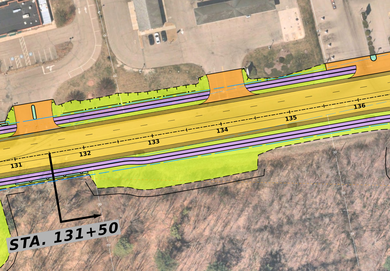
About 3,100' of lanes are being added in the current project design. Information below is provided from south to north. The numbers on the center of the road are called stations and there is one station every 100'. For each lane addition, we provide the NHDOT diagram followed by Google Street View pictures of the current condition.
Guide
Purple: multi-use trail.
Yellow: car infrastructure.
Orange: driveway.
Green: greenspace/vegetation.
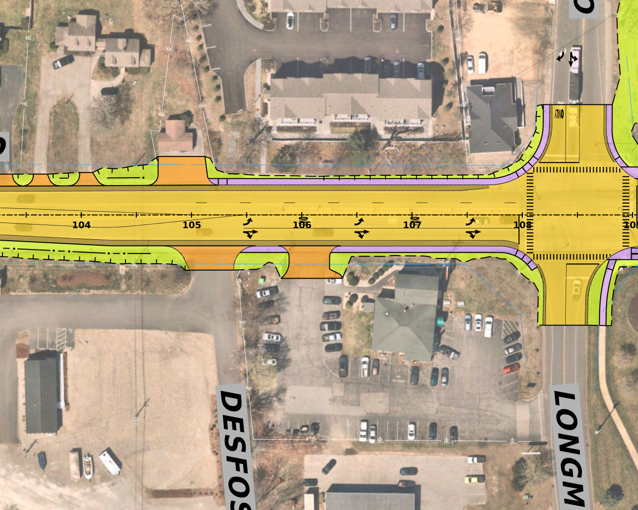
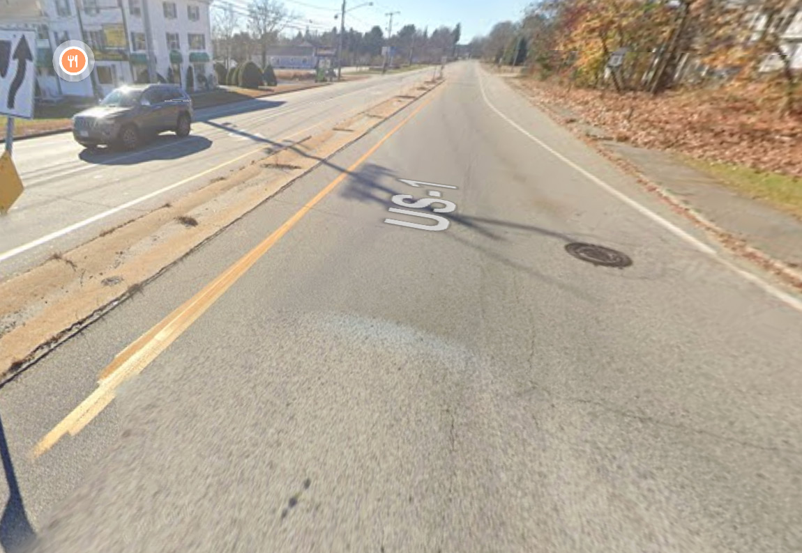
Station 105 @ Ocean, 300'
NB turn lanes are existing, SB additional lane is new.
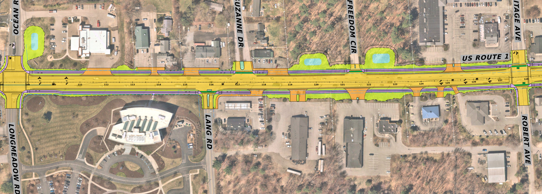
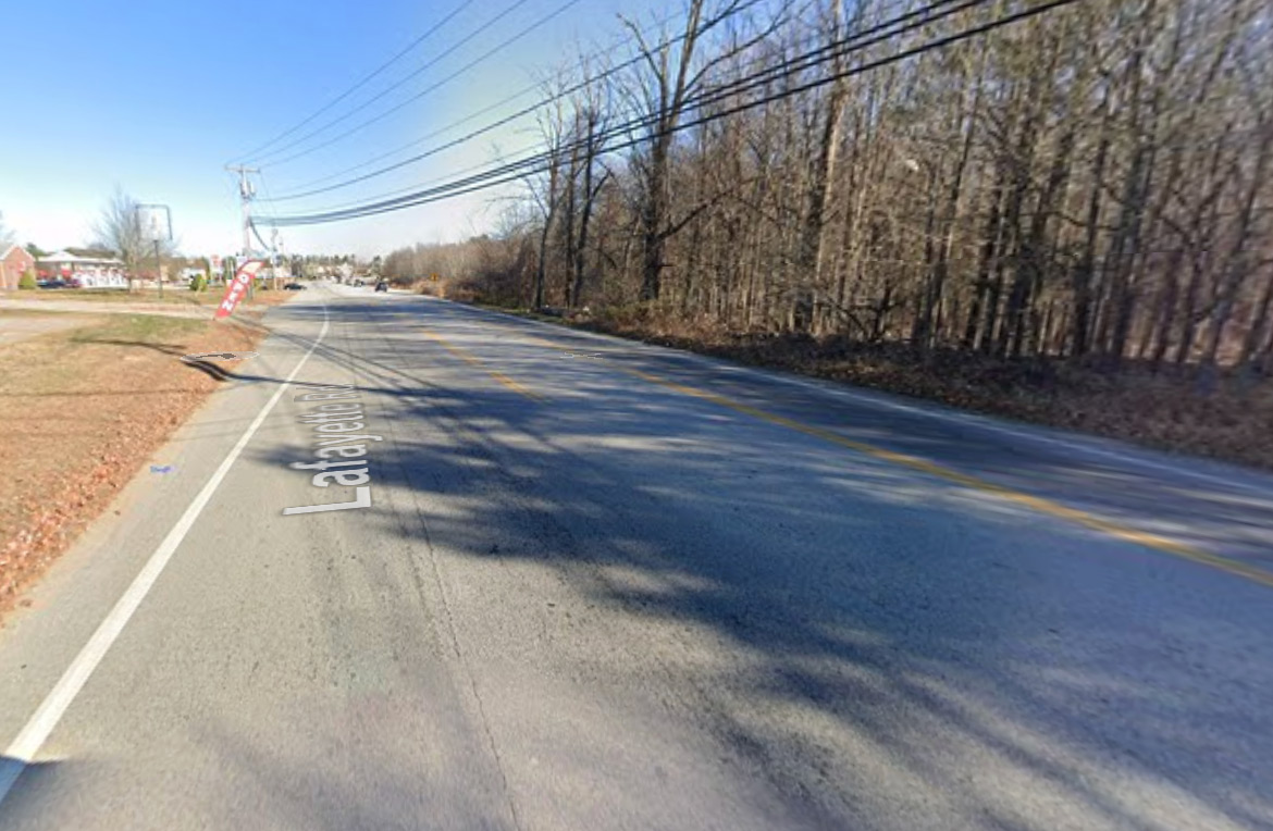
Station 109 @ Longmeadow - Heritage, 1850'
SB additional lane is new.
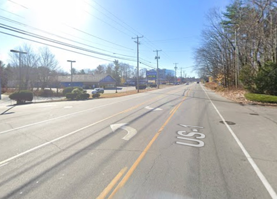
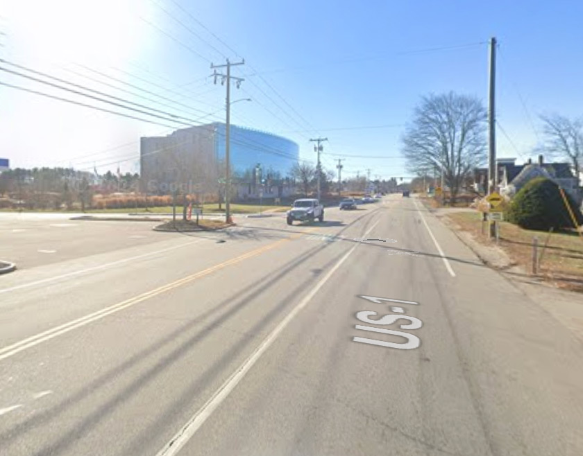
Station 130 @ The Outlet, 600'
SB additional lane is new.
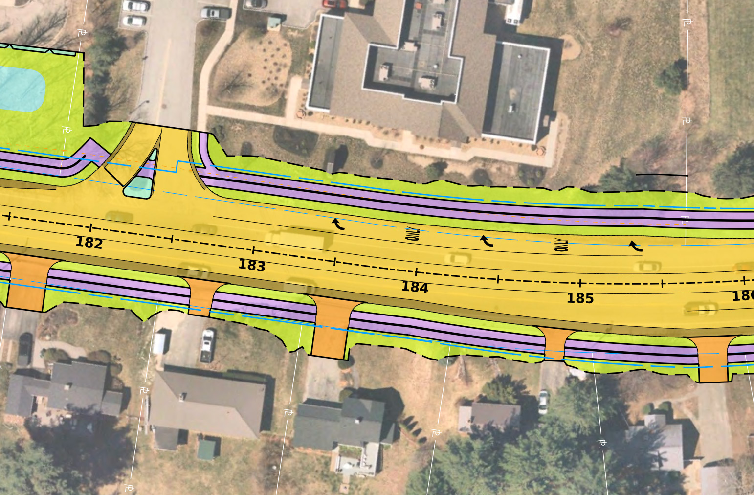
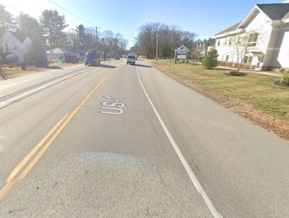
Station 182 @ Orthopaedic Center, 250'
SB turn lane is new. NHDOT representatives claim this lane is in the "permitted layout" which is irrelevant - it does not exist currently. January 21, 2025: This may have been reduced.
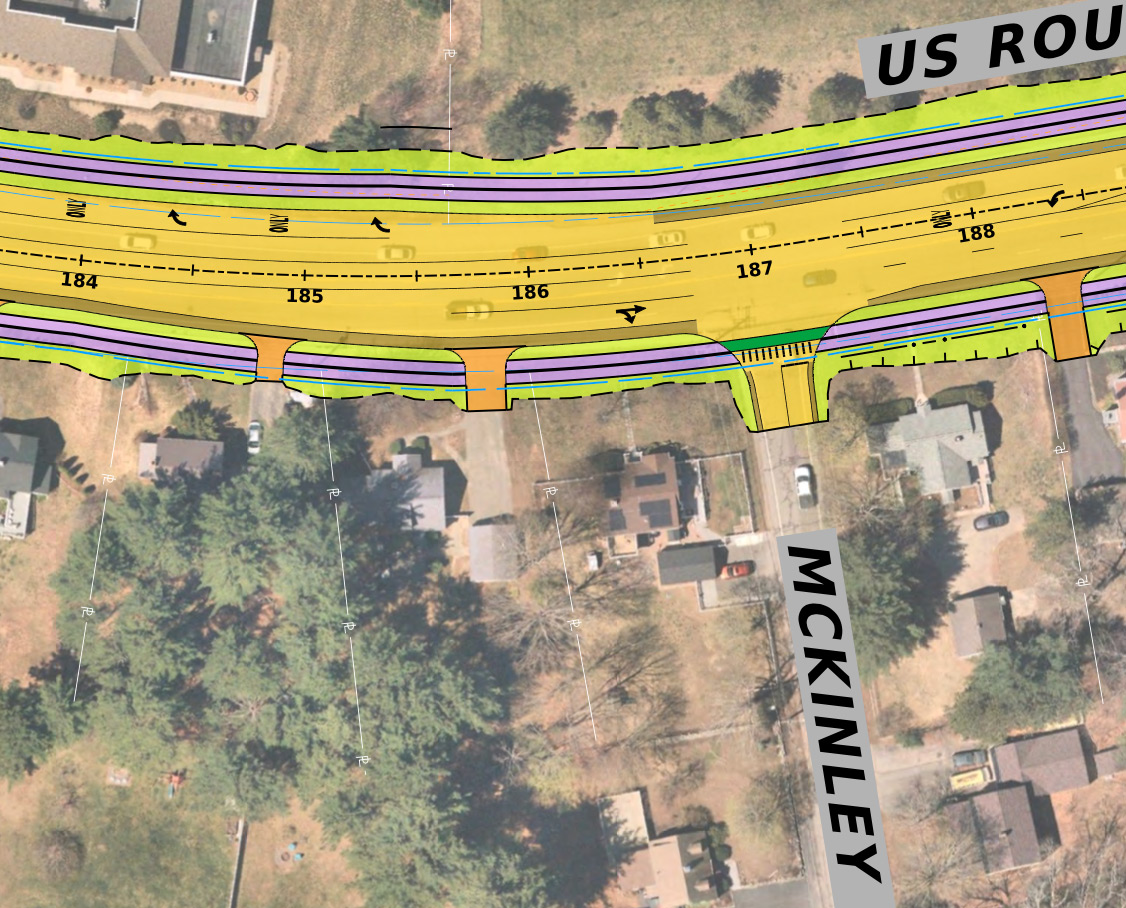
Station 185 @ McKinley, 100'
NB turn lane is new. January 21, 2025: This may have been reduced.

Contact Us · Image Attribution
Portsmouth Climate Action Plan · Portsmouth Complete Streets